We slept well in the motel, ate oatmeal and the rest of the groceries we had purchased the night before, and left just after 9 AM with rested legs and full stomachs. Our bodies feel like they are adapting to our new reality. And we love being able to just forget what time it is, talk together, zone out, and enjoy the beautiful ride. We started on a nice frontage road that eventually veered off into some small mountains – the road was nice and the grade was rideable. We were rewarded at the top with the world’s cleanest pit toilet.
We continued to follow frontage roads toward St. Regis, MT. Again our routing software tried to send us down a private road that had been closed, but gratefully it happened within a mile of an I-90 on-ramp, so it was easy to recover and reroute. I-90 has a great shoulder – the size of a full lane – and rumble strips which keep distracted drivers aware. Eventually we hit road construction, but this turned out to be great: we had the entire westbound freeway to ourselves and the construction crew. Probably the safest freeway experience possible. We talked with them as we rode by and pretended we belonged there.
At St Regis we found the start of the Route of the Olympian, named after the train that used to run on that route. It is a 31-mile gravel trail with a gentle uphill slope (1-2 percent grade) which would be our route for the next five hours. The trail started off quite rough with larger loose gravel, but it improved at times. We can ride on loose gravel, but we can’t ride on soft gravel. It was just barely rideable for us and our bike.
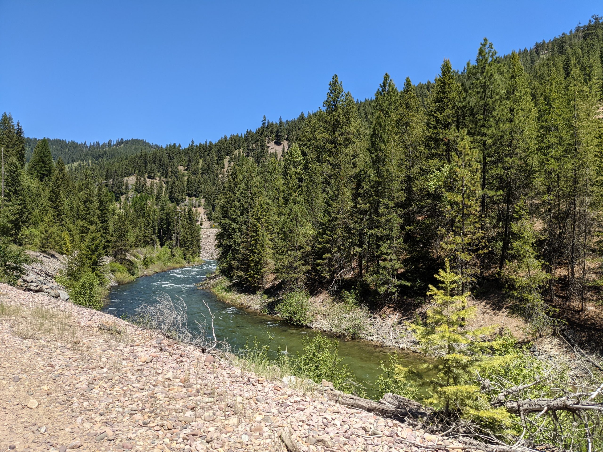
We met a nice couple in a side-by-side who gave us some trail information. There was one part where we had to navigate around a river, but with their trail information we were able to cross a few hundred yards above on a normal bridge.
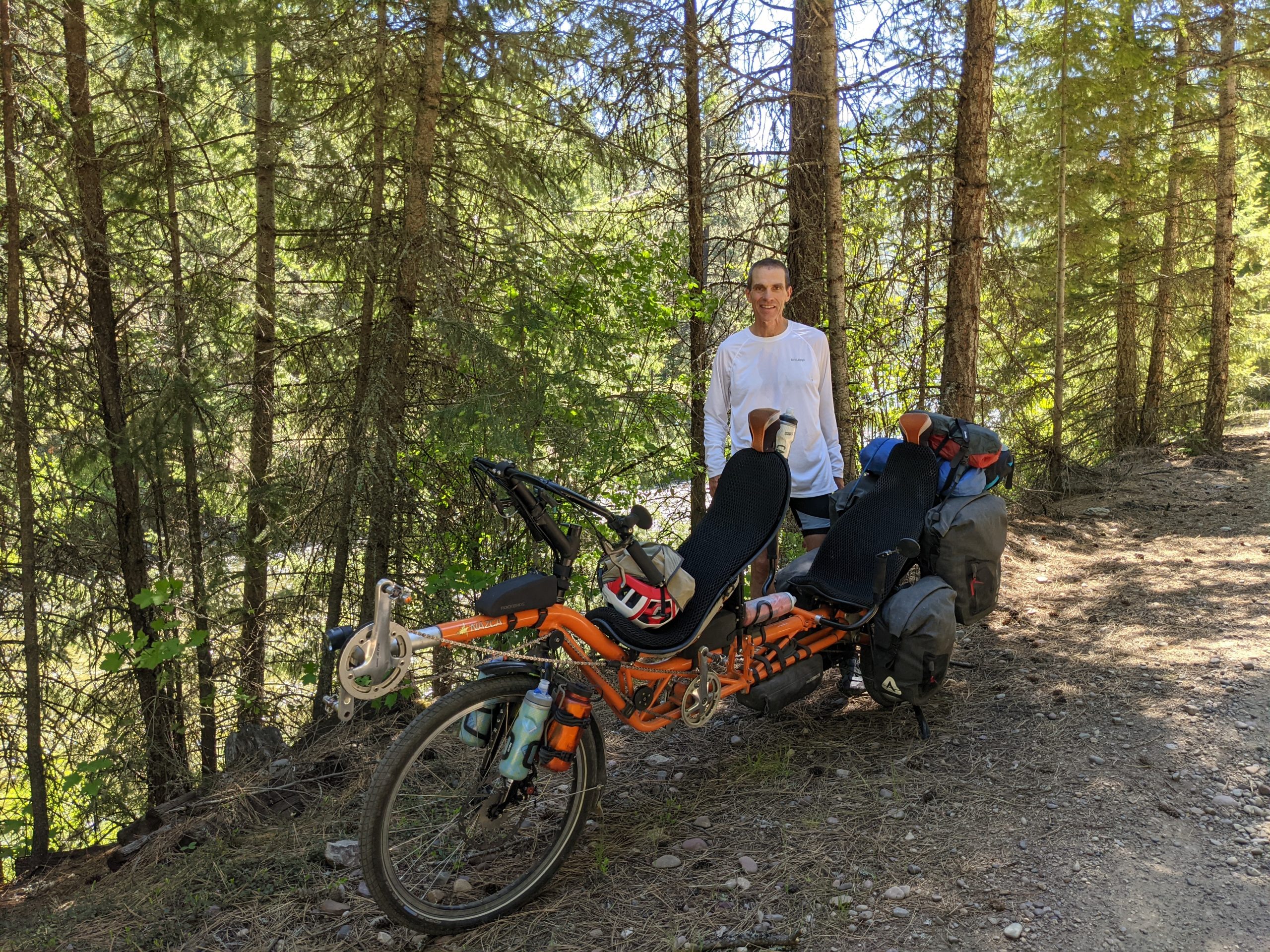
For the next several hours we didn’t see anyone other than another pair of riders, one on a recumbent bike. They were riding east from Seattle, and planned to make it to Boston, in about 50 days. It was fun to sit and chat with them for a while and exchange information about the trail.
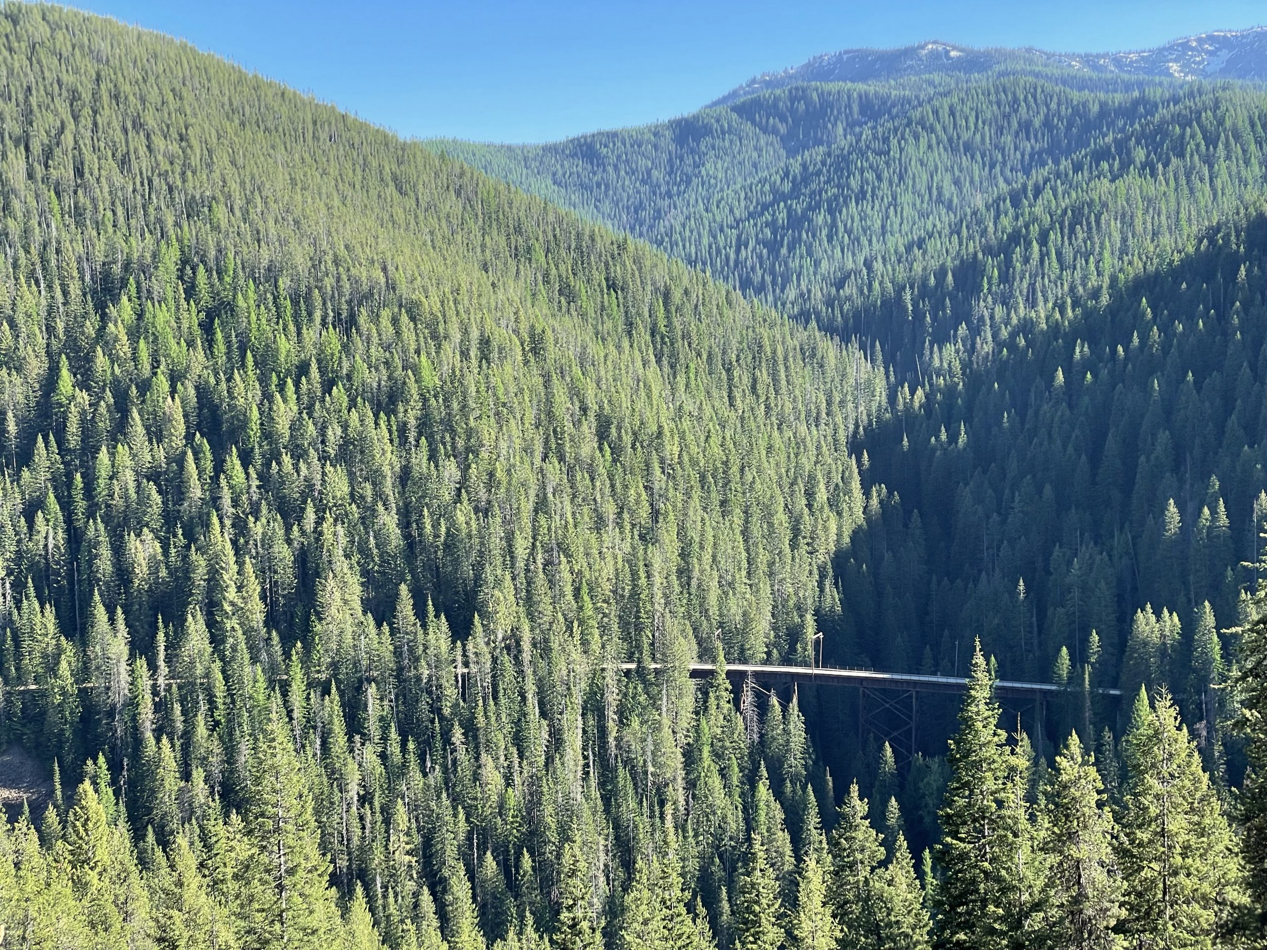
Near the end of the Route of the Olympian, where there wasn’t a good option to turn around (something that wouldn’t cost us a couple hours), the trail appeared to be closed. There was a gate, with a small gap that we thought we could fit our bike through. Right after the gate there was a large tree fallen across the road, and then a big trestle (very high bridge). I walked across the trestle to verify the other side would be passible, and then saw an old railroad tunnel that we would be riding through, so I walked over to be sure we could get all the way through that too. I saw some bike tracks coming out of it so I figured we could make it. By the time I got back to the bike it had been about 10 minutes and Natalie had begun to worry she’d have to send a rescue party.
Since it takes about 10 minutes to unload our bike we decided to leave the panniers on it while we pushed it through, around, and over the obstacles. It was an awkward push, but eventually we made it around the gate and over the tree, then rode over the trestle and around the gate in the other side. We are grateful for our sturdy steel bike which puts up with our abuse. After making some minor repairs we were on our way again, riding through the tunnel which was indeed open on the other side. It is an interesting feeling to enter into the blackness of a tunnel unable to see light at the other end. This was a difficult and beautiful section of our ride. We were tired from the multi-hour climb, but in a peaceful mental zone. It usually takes 2-3 days for me to stop worrying about work and this part of the ride was where it happened for me.
We continued to follow the Route of the Olympian for about another 5 miles until we arrived at the eastern entrance of the Route of the Hiawatha (named also for a train that used to run there). It was 5:30 PM and we hadn’t figured out our next move. We could have ridden to Wallace, but then if we wanted to ride the Route of the Hiawatha we would have had to push our bike back up the steep parts of the hill the next day. We considered camping in the area, but rode up to the entry point to the route and talked to the rangers there. Since we were riding through and wouldn’t need a shuttle back up to the starting point they kindly allowed us to start even though the trail was closing for the evening. This ended up being an amazing opportunity to ride the trail alone in the peaceful evening without the normal crowds. We had it all to ourselves after the 2nd mile. The first tunnel is over 1.6 miles long, so it is quite the experience being in the dark and cold (56 degrees.) We went through 10 tunnels and across 7 beautiful trestles with massive views of the landscape. It’s hard to describe how beautiful the experience was. It was slightly downhill the whole way and we covered the entire 15-mile route in about an hour. It went too fast. We will actually be doing it again with Vance and Page next week, and we are so happy about that. We are also so grateful that someone had the vision to preserve this engineering wonder and make it into a bike trail. We’ve ridden in some crazy beautiful places, and this is at the top of our list. It is easily approachable for any rider with a little experience, because it goes downhill the whole way. Shuttles can carry people back to the top. Put it on your bucket list, regardless of your age. You won’t be disappointed.
We followed a road into a small town in Idaho named Avery. It was all downhill. It was gravel, but rideable. We are appreciating the larger tires we put on our bike for this trip. It makes it a little less efficient on the asphalt but much more stable on the gravel.
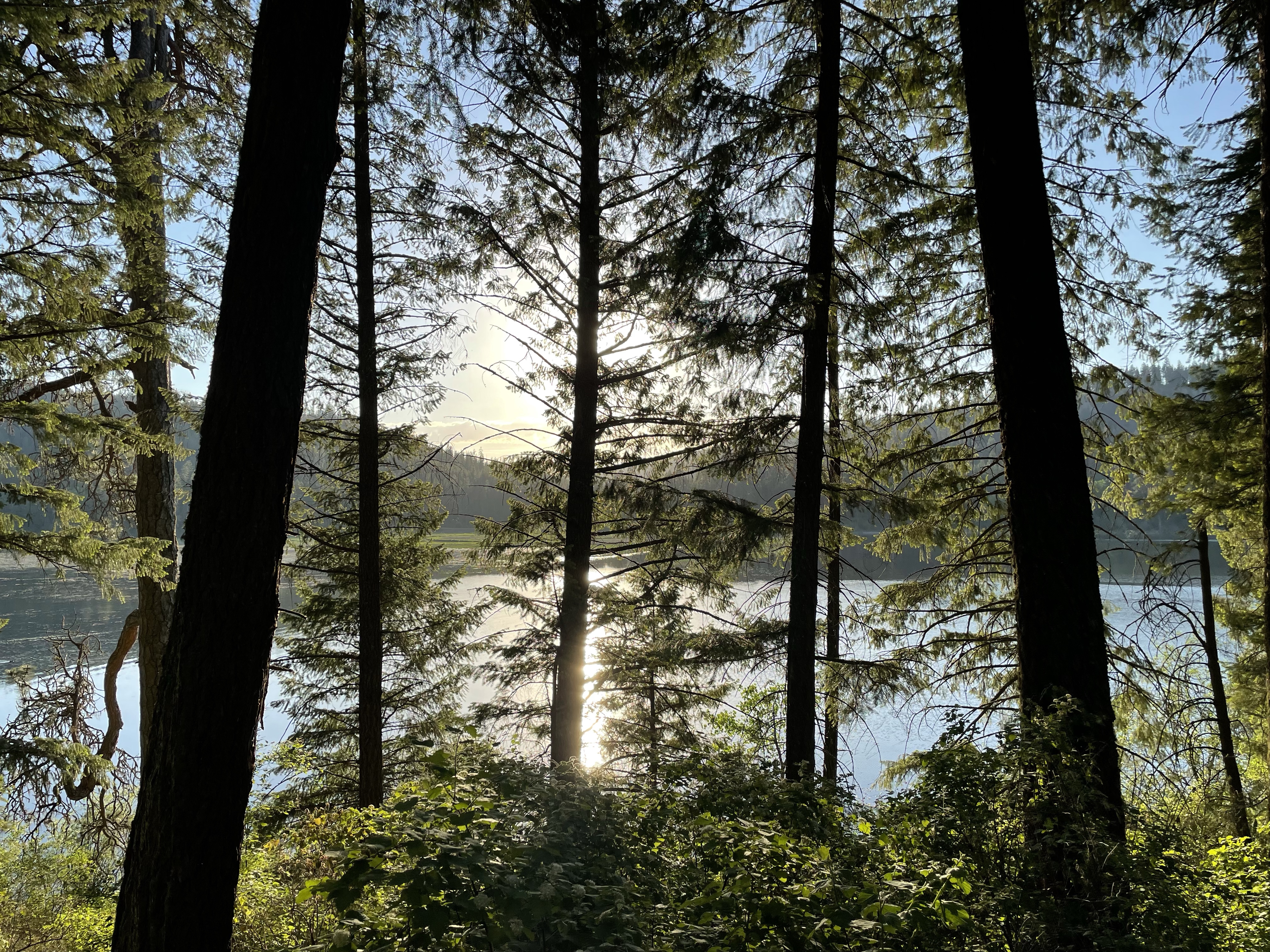
In Avery (population 25) we almost camped near the river. The landowner gave us permission, and there was a portable toilet nearby, but there was also a small hotel with one available room, so we took it. That way we’d have a shower, full kitchen, and connectivity. There is no cell service in Avery. It is a great place to stay if you want to escape the busy world.
The hotel is perfect, the river is beautiful, and we are resting well. We’ve adjusted our route over the next three days and we will ride along the eastern side of Lake Coeur d’Alene and end up in Spokane on Saturday for a rest day Sunday.
Rough stats for the ride: 71 miles, all but 16 on dirt or gravel, around 2200 feet climbed, and about 7 hours of ride time across 10 hours of clock time.
This trip is teaching us to focus on the journey. Unlike previous rides, we don’t have a definite destination. We are wandering and it is refreshing. We’ve decided to ride to Spokane over the next 3 days, so perhaps we’re not wandering purists, but we’ve loved removing some of the stress of travel. It is mostly good to be together, be in nature, and have time to ponder. We also really love the sense of physical work and accomplishment, as well as the adventure.
Here is a link to out photos for the day.
Food facts:
*In 24 hours we ate a whole “net bag” of Cuties oranges (plus so much other food of course).
*Best Diet Pepsi ever at the top of the Route of Hiawatha: we were hot and almost out of water.
*We’re grateful we brought some good camp food along, because we haven’t been close to a grocery store (or really any restaurant) since Missoula.
*Favorite foods of the day (besides Cuties oranges): snap peas, banana chips, and chocolate raisins